
Thought the worst of the severe weather has passed Baldwin County the National Weather Service in Mobile has issued a rip current statement, flood watch, flood advisory and flash flood warning for Baldwin County due to severe weather in the area on Monday, May 13.
Monday's south winds range from 10 to 15 mph, with gusts as high as 20 mph. New rainfall amounts between 1 and 2 inches possible, followed by a 70% chance of precipitation on Tuesday, with new rainfall amounts between a half and three quarters of an inch possible.
(3:29 a.m.) "Dangerous rip currents expected from 7 a.m. this morning through Thursday morning. Rip currents can sweep even the best swimmers away from shore into deeper water. While rip currents may start off low this morning, they are expect to rapidly increase to a HIGH risk this afternoon."
(5:04 a.m.) "Flood watch remains in effect through Tuesday afternoon (until 1 p.m.). Flooding caused by excessive rainfall continues to be possible. Excessive runoff may result in flooding of rivers, creeks, streams, and other low-lying and flood-prone locations. Multiple rounds of showers and thunderstorms will move across southeast Mississippi, southwest and south central Alabama and the western Florida panhandle from early Monday morning through Tuesday afternoon. Widespread rainfall amount between 3 and 6 inches with locally higher totals over 8 inches will be possible. These heavy rainfall amounts will bring an increased potential for flash flooding to the region."
(9:48 a.m.) "Flood advisroy in effect until 1 p.m. this afternoon. Flooding caused by excessive rainfall is expected, minor flooding in low-lying and poor drainage areas. Doppler radar indicated heavy rain due to thunderstorms. Minor flooding is ongoing or expected to begin shortly in the advisory area. Between 1 and 2 inches of rain have fallen. Additional rainfall amounts of 2 to 3 inches are expected over the area. This additional rain will result in minor flooding."
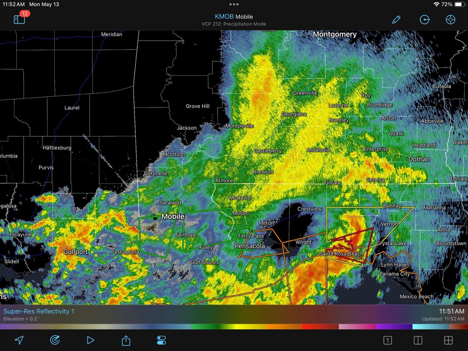
(10:06 a.m.) "The National Weather Service in Mobile has issued a Flash Flood Warning for Southern Baldwin County in southwestern Alabama, West Central Escambia County in northwestern Florida (until 1:15 p.m.). Doppler radar indicated thunderstorms producing heavy rain across the warned area. Between 2.5 and 3.5 inches of rain have fallen. Additional rainfall amounts of 2 to 3 inches are possible in the warned area. Flash flooding of small creeks and streams, urban areas, highways, streets and underpasses as well as other poor drainage and low-lying areas is ongoing or expected to begin shortly."
Precautions/Preparedness Actionds (via NWS)


