
Editor's note: This article and all of Gulf Coast Media's hurricane coverage is free as a public service. We believe having access to reliable, accurate and up-to-date local information before, during and after inclement weather is critical to the vitality and safety of the communities we serve and that money should not be a barrier to that access. We do, however, rely on paying subscribers to to support our independently, family owned business. If you value the local news you're reading and are not a subscriber, please consider becoming one today at gulfcoastmedia.com/subscribe.
***
You can put your Halloween decorations back outside and the cushions back on your porch furniture.
Hurricane Ian is about to pop into the Gulf of Mexico and local meteorologists say it is definitely not headed for Baldwin County. The strong storm will however send high winds and strong surf toward Alabama’s coast and Baldwin residents should avoid hosting bonfires this weekend.
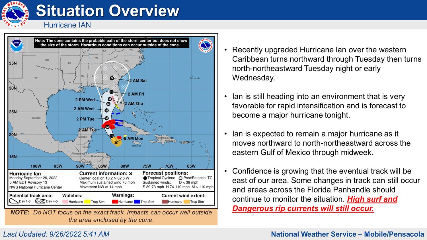
The now category 3 storm’s track remained in question until late yesterday as atmospheric conditions shifted leaving forecasters worried about the storm’s ultimate destination.
Hurricane Ian rapidly intensified overnight, as expected, and is currently churning over Cuba. Morgan Barry, a meteorologist with the National Weather Service, said the data is tracking a landfall on the western side of the Florida peninsula late Wednesday or early Thursday.
However, Baldwin County residents will feel some impacts from the powerful storm.
First, if you are hosting a get-together this weekend to watch a football game or the much-anticipated release of “Hocus Pocus 2,” don’t do it around a bonfire.
The region, including Baldwin County, is under a fire warning meaning conditions are ripe for small fires to easily burn out of control. Today's cool morning was delivered by a cold front that moved dry air into the region.
Expected strong winds from Hurricane Ian plus that drier air means fires can easily become out of control.
“It’s not a great idea to be burning anything outside over the next few days,” Barry said.
Winds in Baldwin County will be 20 – 30 mph with gusts of 40 mph.
The county’s coastal region will see high swells, high surf and strong currents all courtesy of Hurricane Ian.
At the same time, that cold front will be pushing against the giant storm, potentially pulling water out of the bays leading to low water issues in those bays over the next few days.
Barry also said not to put the generators away quite yet.
Those strong gusts may knock out power lines and trees, but widespread damage is not expected.


